



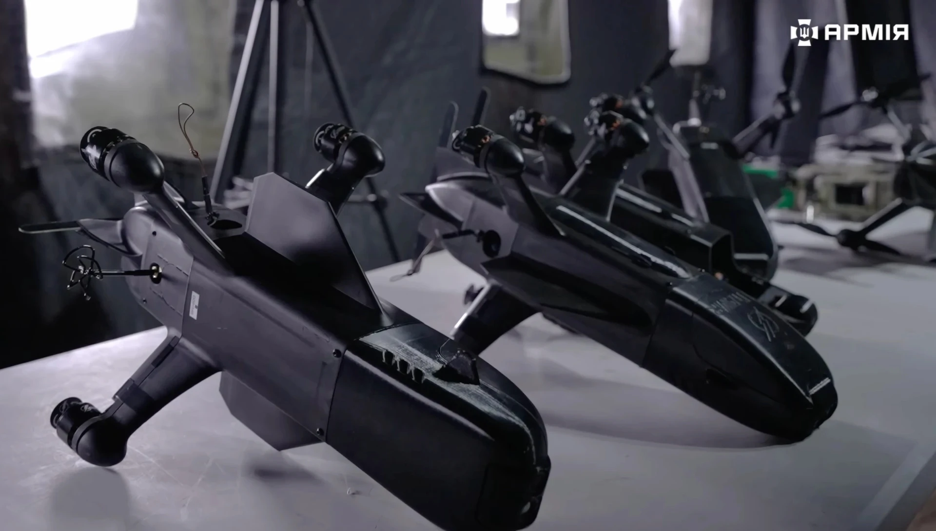





















At night in Russian-occupied southern Ukraine, a white vehicle stood outside a small house. For the Ukrainian unit watching the site, that detail mattered more than the building itself: a fresh satellite image suggested that the Russian personnel they were tracking had likely returned.
Dozens of kilometres away, a Ukrainian drone team was preparing an armed unmanned aircraft. In the past, a target like this could have moved long before a satellite image passed through analysts and commanders. Now, in favorable conditions, new imagery can reach troops within roughly 15 minutes.
Speed is the critical change. Ukraine has used satellite intelligence for years, but high-resolution imagery was once largely the preserve of senior headquarters. By the time information moved through the command structure to the soldiers who could act on it, hours — and sometimes days — might have passed.
For a fixed warehouse, such a delay may not be decisive. For a vehicle, command post, electronic-warfare system or group of soldiers, it can make the intelligence worthless. The new model is designed to deliver information while a target is still likely to be where the satellite saw it.
Daycom’s analysis indicates that the most important technological shift is taking place not in the satellite or the drone alone, but in the connection between them. When sensors, analysts, commanders and operators are linked in a short digital chain, the chance of striking a target before it moves rises sharply.
Modern commercial satellite constellations can revisit the same area many times in a single day. Under favorable conditions, images may reach users within minutes of collection, although the process often takes longer in practice. Even a delay of a few hours, however, is a major improvement on the recent past.
That changes the logic of target hunting. What matters is often not a single image, but the difference between successive ones: fresh vehicle tracks across a field, newly cleared ground in a tree line, a car that has changed position or equipment suddenly appearing beside a building.
Large image archives are becoming a form of battlefield memory. Commanders can compare what an area looked like yesterday, a week ago or a month ago, searching for subtle changes that might reveal a concealed installation, a resupply route or a piece of military equipment hidden under cover.
This matters because drones have already transformed what the battlefield looks like. Large concentrations of armour, open vehicle parks and major supply depots have become increasingly dangerous. Forces disperse equipment, conceal it in shelters and tree lines, and avoid exposing valuable assets for long periods.
Finding a target can therefore be harder than destroying it. Reconnaissance drones can be shot down, jammed or detected through their communications. Their range and coverage are limited, particularly when commanders need to search tens of kilometres behind the front rather than directly above it.
Satellites do not replace aerial reconnaissance, but they can tell it where to look. Orbital sensors can identify a suspicious change across a broad area, after which another system can confirm the location and an armed drone can be sent against a much narrower target.
The result is a layered kill chain. Space-based sensors identify changes, software compares new imagery with older data, a ground team refines the information, commanders approve the target and a strike platform receives coordinates. A later satellite pass can then help determine whether another attack is necessary.
Ukrainian units have already used this approach against Russian electronic-warfare systems, logistics facilities and other infrastructure in occupied territory. Systems designed to disrupt satellite communications are particularly valuable targets because disabling them can create opportunities for further drone operations.
That creates a striking technological cycle. Russia deploys equipment intended to interfere with the satellite links used by Ukrainian drones. Ukraine then relies on other space-based capabilities to locate those jammers, monitor their movement and prepare strikes against them.
Every advantage quickly produces a countermeasure. More resilient communications encourage more sophisticated jamming, while new jamming systems themselves become high-priority targets. In a technology-driven war, an advantage lasts only as long as it takes the opponent to understand it and respond.
The integration is especially valuable deep inside occupied territory, where conventional frontline reconnaissance becomes harder. Satellite imagery can help monitor air-defence positions, warehouses, supply routes and staging areas without requiring an unmanned scout to remain continuously above the target.
This has particular importance around occupied Crimea. Ukraine has repeatedly sought to disrupt the peninsula’s military logistics, transport infrastructure and support networks. Faster imagery allows commanders to assess the effects of strikes sooner and identify repairs, new routes or relocated equipment.
“Near real time,” however, should not be confused with a continuous video feed from orbit. A satellite passes over a particular area during specific windows, after which the data must still be transmitted, processed and delivered. The best cases may take minutes, but delays can stretch to hours.
Weather and sensor type also matter. Optical satellites can be hindered by cloud cover and darkness, so a high revisit rate does not automatically guarantee a useful image. More persistent surveillance requires a mix of optical, radar and other sensing technologies.
There is also a risk that speed creates its own vulnerabilities. The shorter the interval between detecting a possible target and using force, the less time remains for additional checks. Faster access to imagery does not mean that frontline operators are free to strike without command approval.
That distinction between acceleration and automation is important. Software can flag changes, compare imagery and help calculate a route, but decisions about whether a target should be attacked still remain within the human command structure. A faster system compresses verification; it does not eliminate it.
Another defining feature of the model is that it does not depend on a single secret military platform. Commercial satellites, geospatial software, secure communications, Ukrainian command systems and different classes of drones are being combined into one increasingly integrated architecture.
The commercial component makes the system more flexible. Some imagery can be distributed under fewer restrictions than classified state intelligence, allowing digital platforms to deliver data much closer to the end user — the soldier or commander who actually has the ability to act on it.
For Ukraine, that flexibility also exposes a strategic vulnerability. Much of the country’s access to space-based intelligence still depends on foreign governments and private companies. Political decisions, licensing restrictions or commercial changes can therefore have immediate military consequences.
Diversification is becoming as important as resolution. The more independent sources of imagery Ukraine can access, the less vulnerable the intelligence chain becomes to the loss of a single provider. Commercial redundancy, allied support and domestic capability all serve different parts of that problem.
Ukraine is also trying to expand its own space capabilities and deepen cooperation with international partners. Building a sovereign constellation comparable with the largest commercial operators is not a short-term project, but even limited national capacity can reduce exposure in particularly sensitive areas.
The lessons extend well beyond Ukraine. Militaries around the world are studying how commercial satellite data can move from strategic headquarters down to tactical units capable of acting within hours or minutes rather than waiting for intelligence to travel through multiple command layers.
In effect, the war is changing the architecture of military intelligence itself. Space-based surveillance, once associated mainly with national intelligence agencies and strategic planning, is becoming a tactical tool — something closer to a live battlefield layer available on the operator’s screen.
In this kind of war, range is no longer enough. The side that sees a change first, interprets it correctly, verifies it and passes the information to a weapon system fastest can gain an advantage even without possessing the most powerful individual platform.
That is why Ukraine’s satellite intelligence is becoming part of a broader transformation of the battlefield. A drone may provide a relatively cheap and flexible means of attack, but its value rises dramatically when it receives accurate information about where a target is now rather than where it was yesterday.
The next phase of the technological race will depend less on the sheer number of satellites or drones than on how effectively sensors, algorithms, communications and weapons are fused into a system that can operate faster than the enemy can understand and disrupt it.
On the Ukrainian front, that change is already measured in minutes rather than abstract technological potential. A satellite image that once showed where a target had been days earlier can increasingly show where it may still be. In a drone war, that difference can decide whether a strike finds an empty position or a live target.